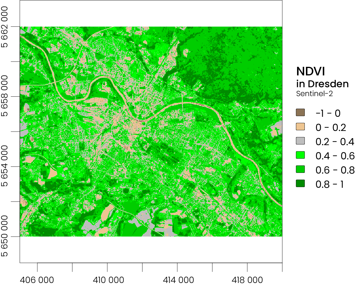
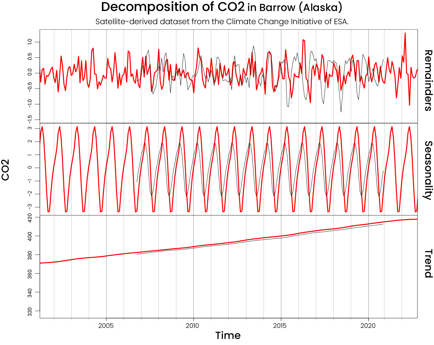
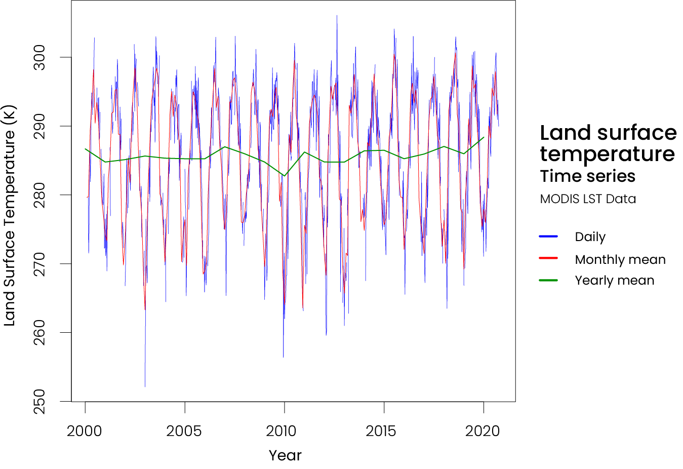
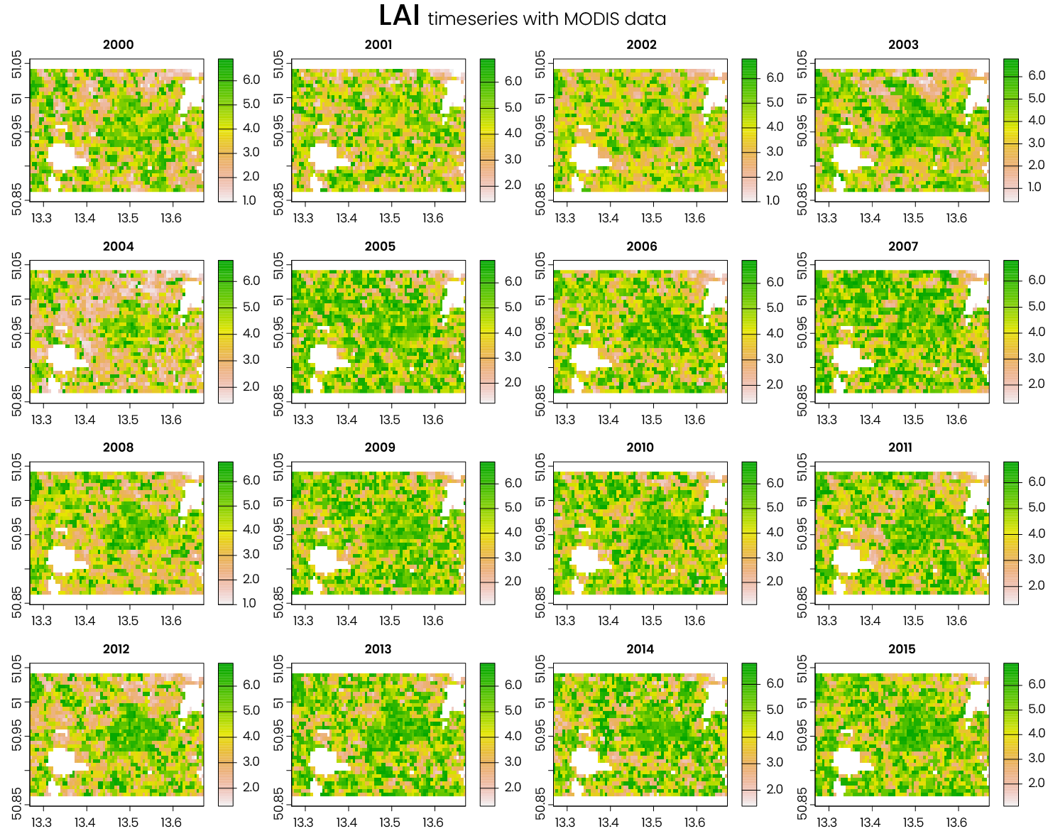
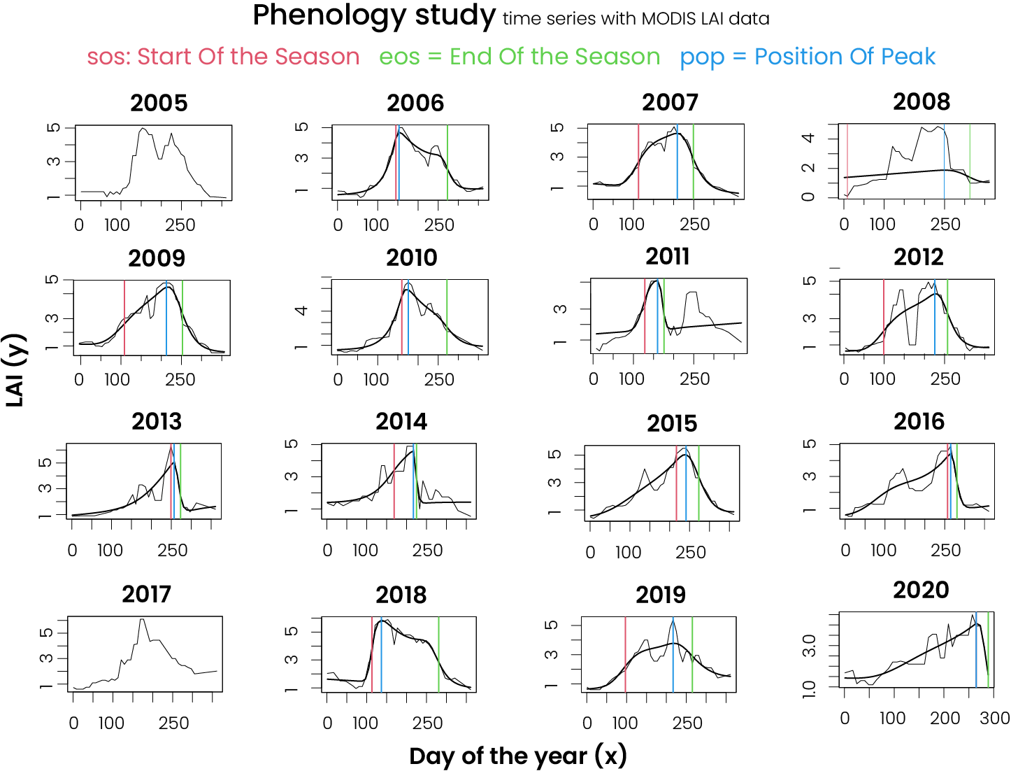
This is a series of experiments I have been doing, to understand the uses and capacities of satellite images (Lansat and Sentinel), in environmental change. All this graphs were made using R (terra, zoo, phenopix package)


Softwares used: R