An artsy walk through Vienna.
Project research, data management and design for Cartography Master, 2022.
Ravenstein Preis 2022.


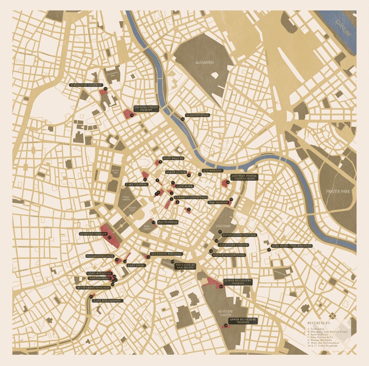
This is not a guide for art or city experts. This project is an exploration on how paper maps can show more than just "the most important" buildings of a city. This guide-map aims to take the wanderer on a journey in which the connection is not only in space but also in time. Thus, this was created by choosing a particular topic: the artistic movement Wien Secession which happened around 1900 in Vienna. This was the artistic outcome of a bigger social and cultural movement which the city experienced and which re-shaped its urban life.
A guide for those who want to understand Vienna by discovering how its artistic, social and cultural movements in 1900 shaped its urban fabric.
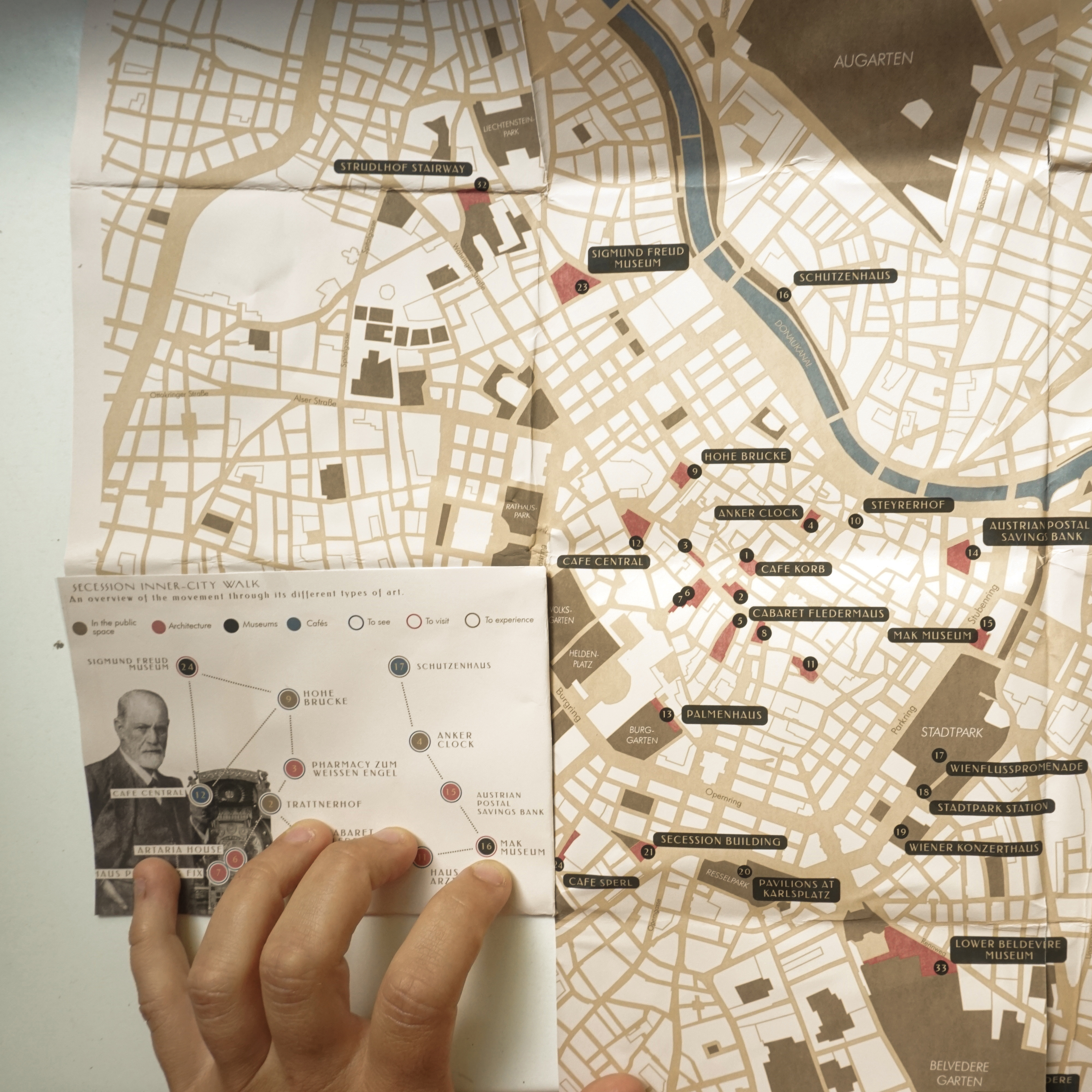
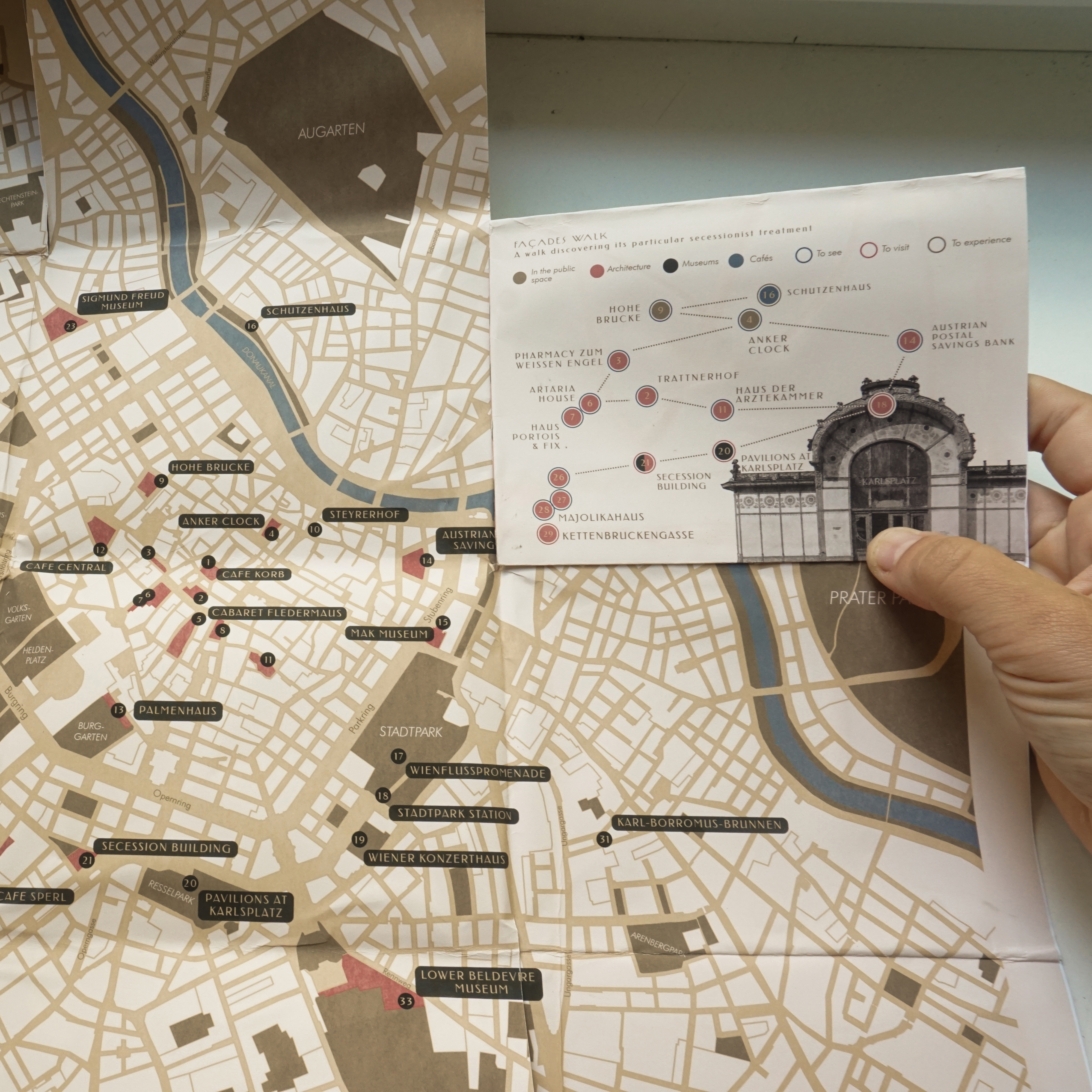
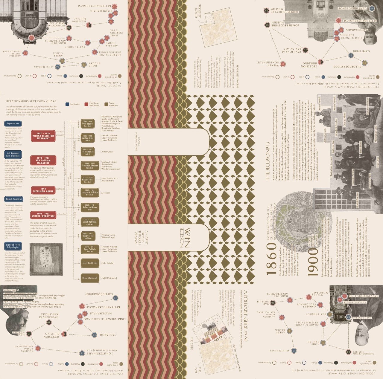
From Otto Wagner to Gustav Klimt, from Sigmund Freud to Joseff Hoffman, this map locates architecture, infrastructure in the urban space and façades designed by secessionists. It also shows museums where their art pieces and history can be found. And naturally, cafés where the members of the Secession used to go, sipped their coffees, smoked their cigars and came up with deep conversations and new ideas.

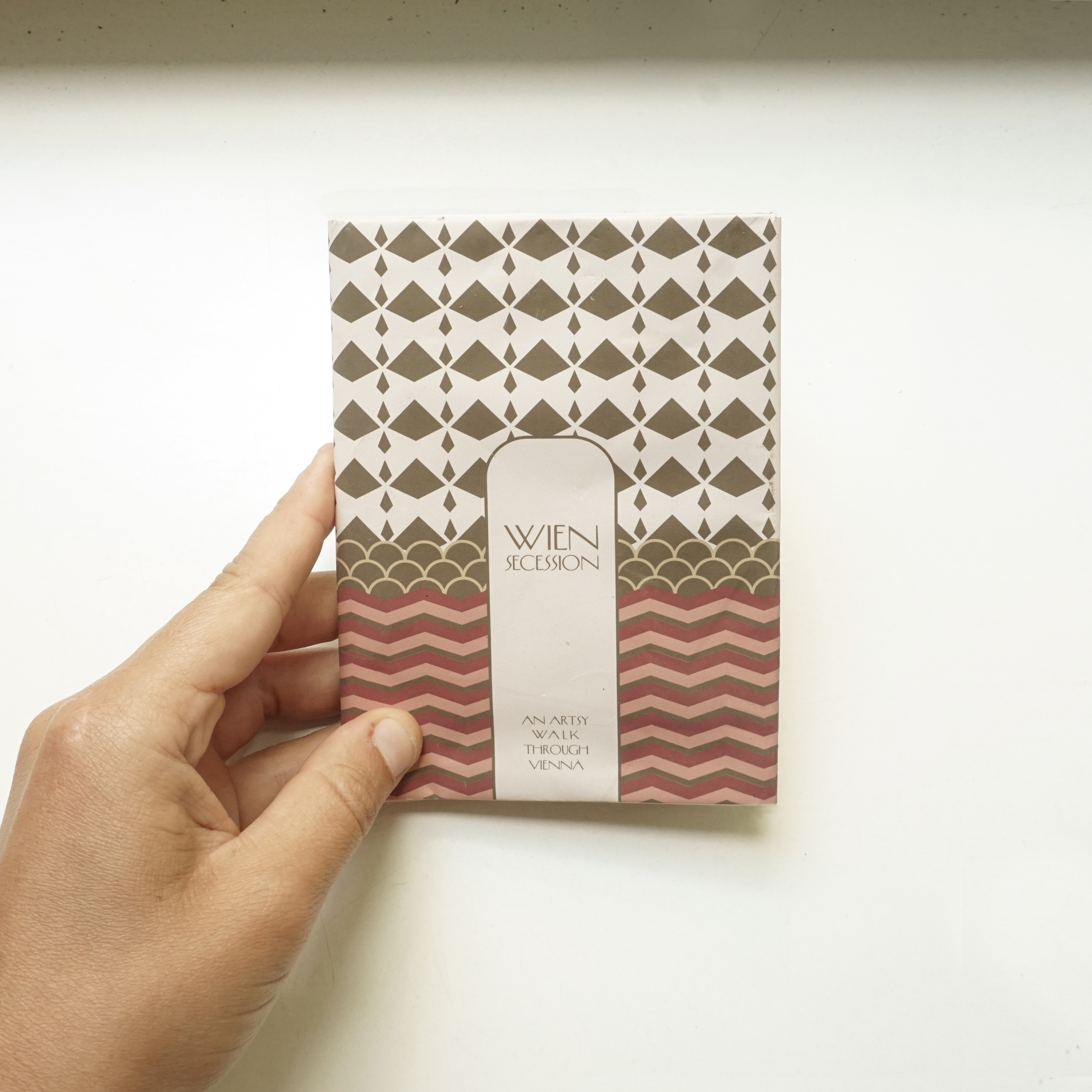
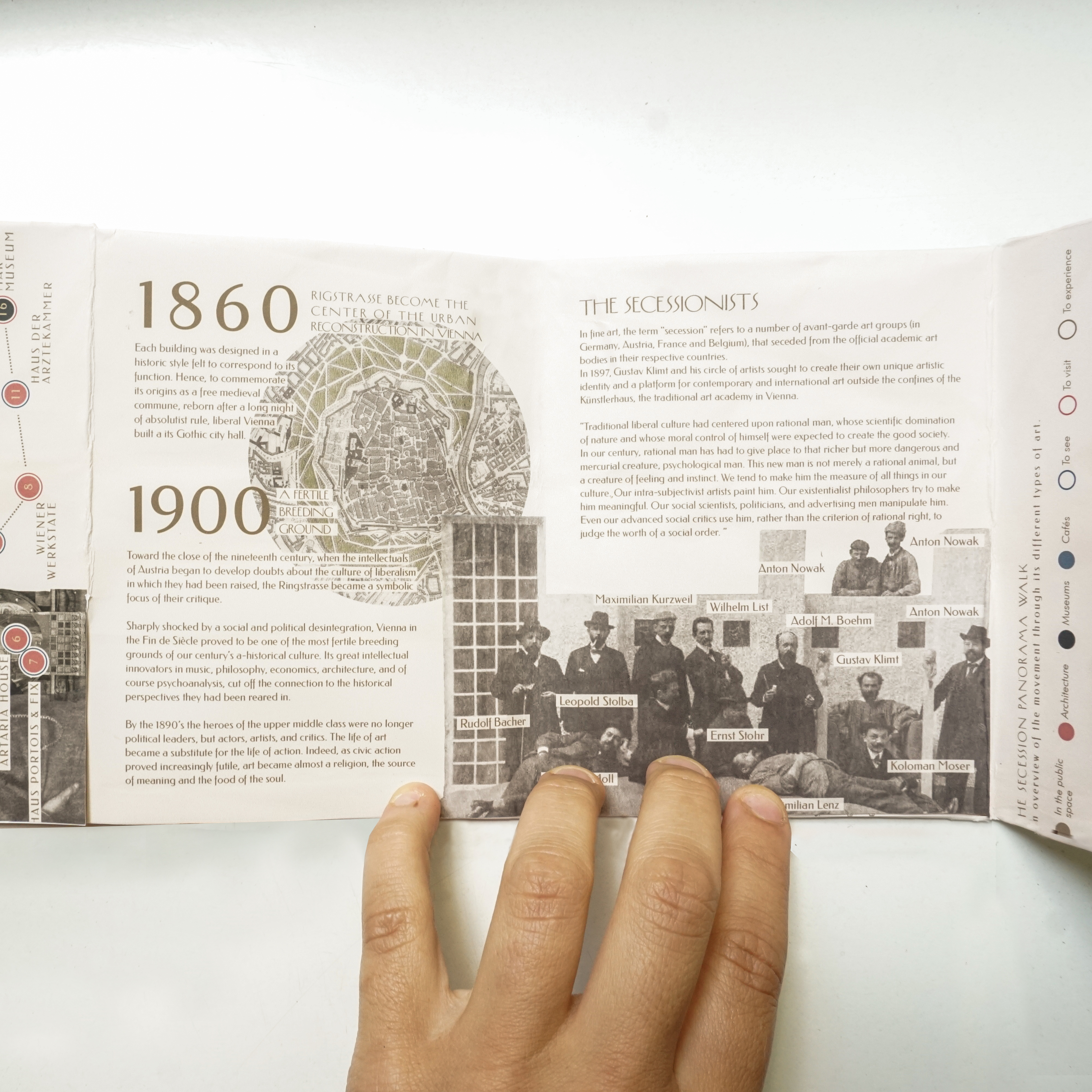
Finally, the simple mechanic of the folding is used to work and be revealed as a book. First an introduction to the guide and how to use it. Then the presentation of the Secession movement, its members, relationships and history. Finally, the simple map which can be layered with 4 different suggested routes located in the 4 corners of the guide. The suggested routes were created in order to reduce the uncertainty of the new explorer, the one of the 21st century who usually has limited time. These walks are divided into two potpourri ones which gives a general idea of the movement mixing all kinds of arts and types of buildings: "Secession inner-city walk" which goes around the 1st district and "The secession panorama walk" which navigates outside the inner-city. Moreover, two more specific routes were created: "A façade walk" and "On the trail of Otto Wagner". With a single folding action, the chosen schematic route can be placed above the main map and can be followed. The decision of not drawing routes in the map was made to let the user depict its own way.
Softwares used: QGIS, Illustrator and Photoshop